Update 10:45 a.m. Wednesday
Similar thunderstorms that were seen on Tuesday blew through the Houston area on
Wednesday morning, causing delays and cancellations to collect once again at George Bush
Intercontinental Airport.
As of 10 a.m. Wednesday morning, the local airport reported 194 delays and 32 cancellations,
according to FlightAware – once again, taking the top spot for the highest number of delays on
the flight tracker website’s MiseryMap.
William P. Hobby saw an increase in delays due to the inclement weather – with 49 reported –
but had only 1 cancellation.
Travelers may see their wait times decrease later in the afternoon, as a majority of the storms
occurred in the early morning hours and are expected to clear by early afternoon, according to Space City Weather.
The weather forecast website warned drivers of the risk of low-lying streets and flash flooding in
certain areas – including those along and south of Interstate 10 – where rain accumulation was
the highest.
Although they still have the Houston area under a Stage 2 Flood alert, Space City Weather
anticipates the storm system to have little to no threat into the later afternoon.
Original Story:
At the height of the storms around noon Tuesday, CenterPoint Energy recorded about 35,000 outages in the Houston area. And roughly another 2,000 in Katy and additional outages in other cities including Spring – where schools in their district relied on generators to maintain power through the storms.
In response to the inclement weather, several school districts including Alief ISD, and Houston ISD canceled after-school extracurricular and sporting activities.
In total, there were about 60,000 outages across the Greater-Houston area; however, according to the CenterPoint outage tracker, outages decreased, and power was restored to many customers later in the afternoon.
Although residents will stay dry throughout Tuesday evening – the forecast shows similar heavy rain falls and strong gusts of wind are possibly picking back up again later Tuesday night and into the early morning hours on Wednesday.
Most areas affected on Tuesday saw several inches of rainfall. This will continue into Wednesday as lighter-affected areas are likely to see between 1-2 inches; while more-affected areas may expect to see up to 6 inches, according to Space City Weather.
The National Weather Service issued a flood watch – upgrading to a warning for parts of central and Northeast Harris County – that went into effect at 10 a.m. on Tuesday and is set to remain in effect until 7 p.m. on Wednesday.
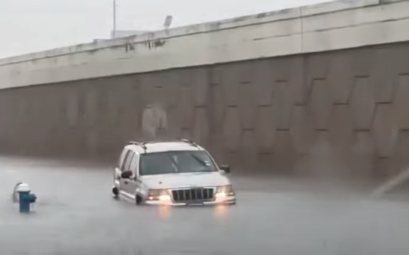
Flooding occurred across the city leaving many drivers wary of high water and the increased chance to skid across the slippery roads in areas near IH-45 North.
Weather forecasters are warning those who live in flood prone areas to be aware of the rising water levels from nearby bodies of water. In preparation for continued rainfall, the City of Houston opened Lake Houston’s spillway dam was to keep the flooding threat to nearby areas down.
According to Space City Weather, there is a 30 to 50 percent chance rainfall will continue into Thursday and Friday. Storms may reappear again on Saturday; however, they are not expected to cause flooding or be similar to those on Tuesday or expected on Wednesday.
Support Us
Houston's independent source of
local news and culture
account
- Welcome,
Insider - Login
- My Account
- My Newsletters
- Contribute
- Contact Us
Strong Storms Expected to Continue, But Some Relief May Come Toward End of Week [UPDATED]
A string of storms hit the Houston area on Tuesday morning and continued into the afternoon; this weather is expected to continue into Wednesday afternoon.
Screenshot
KEEP THE HOUSTON PRESS FREE...
Since we started the Houston Press, it has been defined as the free, independent voice of Houston, and we'd like to keep it that way. With local media under siege, it's more important than ever for us to rally support behind funding our local journalism. You can help by participating in our "I Support" program, allowing us to keep offering readers access to our incisive coverage of local news, food and culture with no paywalls.


Use of this website constitutes acceptance of our
terms of use,
our cookies policy, and our
privacy policy
The Houston Press may earn a portion of sales from products & services purchased through links on our site from our
affiliate partners.
©2024
Houston Press, LP. All rights reserved.
