We took a glance at the calendar on Sunday. It said March 31, but we swore it was January 31. Temperatures hovered in the 50s all day long under overcast skies. We avoided rainfall, which made the day not too bad, even outside assuming you had a jacket on. You'll get one more day of this cool weather before things begin to get back to normal spring in Houston.
Monday should be a stunner of a winter day in Houston, even if it is April 1. Lows will dip into the low 40s, so you will definitely want to dress warmly for that morning walk. Highs won't make it much above 60 degrees under mostly sunny skies. It will be chilly, but it will be beautiful.
Tuesday might be even better than Monday. Winds will start to shift out of the east we will still remain dry and mostly sunny with highs in the low 70s and lows in the 50s.
By Wednesday, a southerly flow should return and bring clouds and humidity with it ahead of a front that will bring rainfall by Thursday. It will still be relatively cool with highs only in the low 70s, but it will still feel muggy and low temperatures will barely be 10 degrees cooler than highs
As the front pushes into the area on Thursday, there will be a good chance of showers and thunderstorms setting up what could be a relatively wet weekend. But, we'll save that for Thursday. Hopefully, a good bout of rain will also help knock out some of the massive levels of pollen we've had recently.
Support Us
Houston's independent source of
local news and culture
account
- Welcome,
Insider - Login
- My Account
- My Newsletters
- Contribute
- Contact Us
Weather Week: Enjoy This Last Gasp of Winter
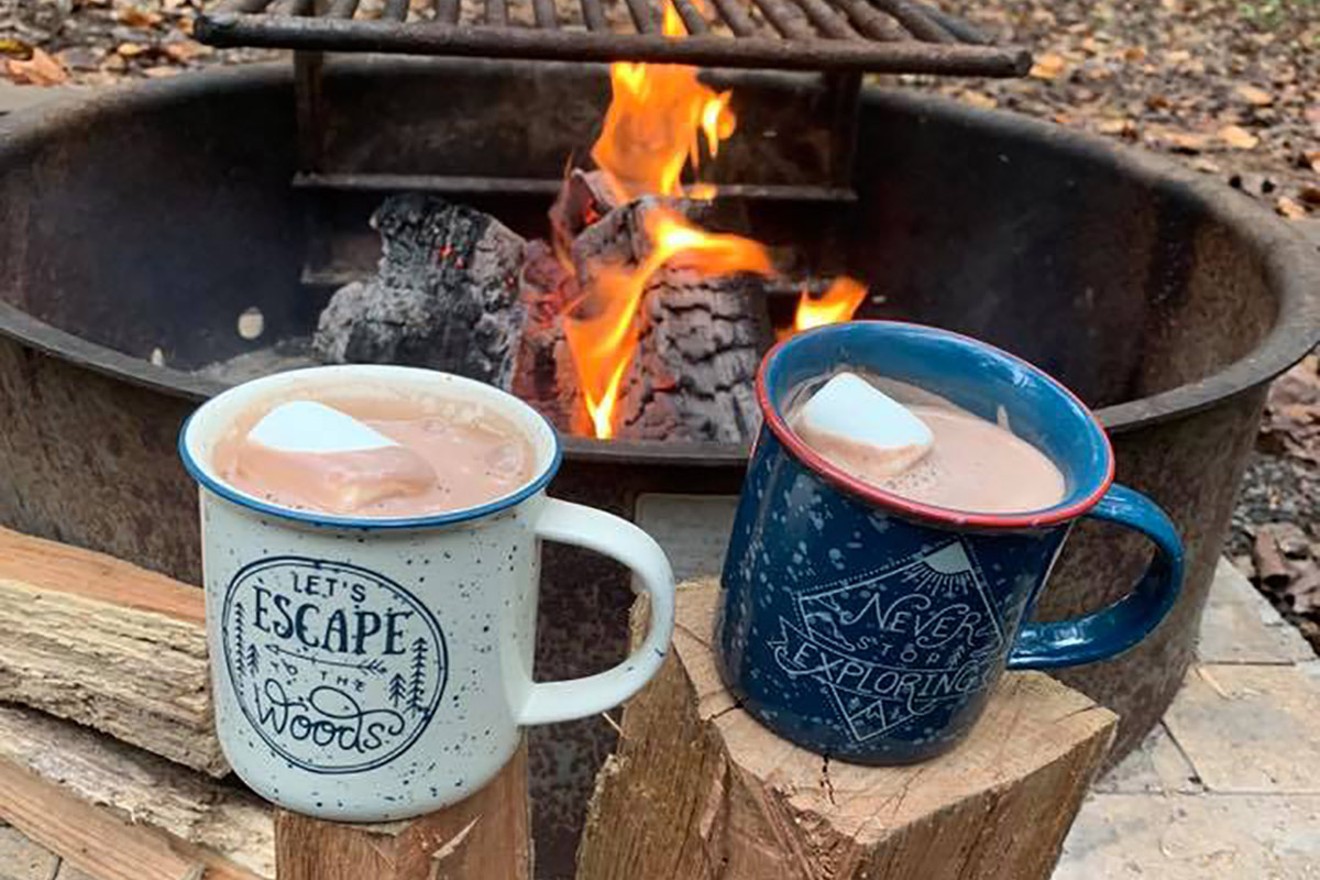
We didn't expect to need this so deep into March, but here we are.
Photo by Virginia State Parks/Flickr via CC
KEEP THE HOUSTON PRESS FREE...
Since we started the Houston Press, it has been defined as the free, independent voice of Houston, and we'd like to keep it that way. With local media under siege, it's more important than ever for us to rally support behind funding our local journalism. You can help by participating in our "I Support" program, allowing us to keep offering readers access to our incisive coverage of local news, food and culture with no paywalls.


Use of this website constitutes acceptance of our
terms of use,
our cookies policy, and our
privacy policy
The Houston Press may earn a portion of sales from products & services purchased through links on our site from our
affiliate partners.
©2024
Houston Press, LP. All rights reserved.
