Well, July 4 certainly was interesting. Parts of the area received as much as 8 inches of rain while most of the city ranged between 3 and 5 inches. The high rainfall rates (some reported at 3 to 4 inches per hour, particularly inside the loop and on the southwest side) contributed to some significant street flooding. Fortunately, it doesn't appear there was any substantial flooding of structures and no injuries were reported, though a number of people drove their cars into high water and were stranded. You guys, why?
The rain was the result of a disturbance that moved west across the northern Gulf of Mexico and through Louisiana over the past few days. It seemed to dissipate in the evening hours on Tuesday but blew back up on Wednesday as it rolled through dumping plenty of rain on the entire region.
Make no mistake, this was no Hurricane Harvey, or the Tax Day flood or the Memorial Day flood. Both the floods on Memorial Day 2015 and Tax Day 2017 dumped well over 10 inches of rain (up to 14 in the case of 2016) and led to some fairly significant flooding of homes including bayous coming out of their banks. As bad as Wednesday was, only a couple of bayous reported came slightly out of their banks (and nothing more than what frequently happens during heavy rainfall in Houston) and no homes took on substantial water.
Now that the ground is fully saturated and the rain-induced PTSD of many Houstonians has reached at least DEFCON 2, what should we expect over the weekend.
The good news is bayous are rapidly draining and as temperatures climb back into the 90s, things will begin to dry up even if there are scattered showers in the forecast Thursday and Friday. Don't expect any flooding like we saw on Independence Day the next couple days.
As a disturbance pushes in from the west late Friday, rain chances again pick up for the weekend. It looks like it could be a soggy Saturday and Sunday with rain chances between 60 and 80 percent both days. No one is expecting the kind of rainfall we had on Wednesday, however.
It won't make for a very pretty weekend, but we probably won't be stranded on the freeway either.
As for the tropics, the season's first Cape Verde disturbance is being given a decent chance of development by the National Hurricane Center, but none of the forecast models give it much of a shot of turning into anything of note. And it is a LONG way out in the Atlantic at the moment anyway.
So, buck up. The worst of this week is over and while rain remains in the forecast, it shouldn't be anything to be concerned about.
Support Us
Houston's independent source of
local news and culture
account
- Welcome,
Insider - Login
- My Account
- My Newsletters
- Contribute
- Contact Us
Houston's Weather Weekend: Wet but Improving
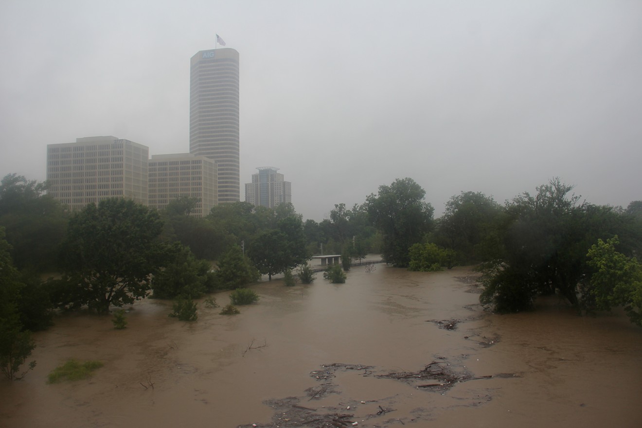
Houston got its first really flooding rains since Hurricane Harvey on the Wednesday holiday.
Photo by Doogie Roux
KEEP THE HOUSTON PRESS FREE...
Since we started the Houston Press, it has been defined as the free, independent voice of Houston, and we'd like to keep it that way. With local media under siege, it's more important than ever for us to rally support behind funding our local journalism. You can help by participating in our "I Support" program, allowing us to keep offering readers access to our incisive coverage of local news, food and culture with no paywalls.


Use of this website constitutes acceptance of our
terms of use,
our cookies policy, and our
privacy policy
The Houston Press may earn a portion of sales from products & services purchased through links on our site from our
affiliate partners.
©2024
Houston Press, LP. All rights reserved.
