This past weekend brought some pretty magnificent weather. It was a bit on the chilly side, but the sun was out and it was pretty lovely overall. This week promises more of the same for the first half of the week with clouds gathering toward the weekend.
Monday will be partly cloudy with highs in the mid to upper 60s ahead of a cold front. As the front approaches Monday night, rain chances will increase to around 60 percent, mostly along the frontal boundary. It will clear out quickly and lows overnight will drop in the mid 30s.
It won't warm up much on Tuesday. Expect highs only around 50 degrees with clear skies and plenty of sunshine. Winds will begin shifting out of the east into the evening and clouds will increase. Wednesday will be cool and cloudy with highs in the mid 50s and lows around 40.
Thursday will be a repeat of Wednesday with highs climbing up around 60 degrees under cloudy skies. Expect it to be rather gloomy as rain chances increase for Friday and into the weekend. It doesn't appear the weekend will be a slog, exactly, but it should be drizzly and gray.
But, for the week, weather should be fairly nice with the exception of a few showers as the front moves through Tuesday night. Enjoy the sunshine before the clouds close in.
Support Us
Houston's independent source of
local news and culture
account
- Welcome,
Insider - Login
- My Account
- My Newsletters
- Contribute
- Contact Us
Weather Week: Cold and Dry Ahead of Warmer, Wetter Weather
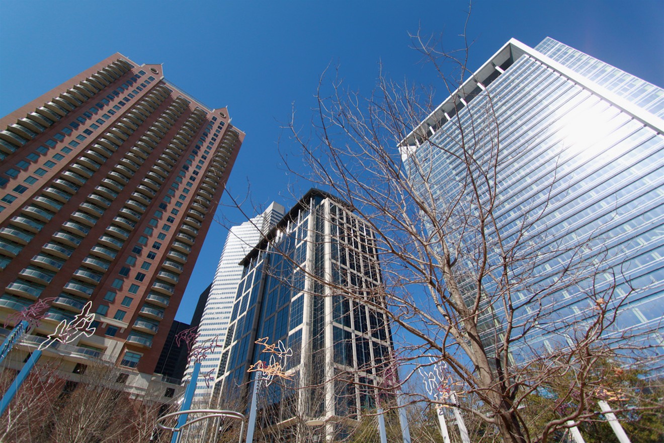
Bright sunny skies, at least for the first half of the week.
Photo by Roy Luck via Flickr
KEEP THE HOUSTON PRESS FREE...
Since we started the Houston Press, it has been defined as the free, independent voice of Houston, and we'd like to keep it that way. With local media under siege, it's more important than ever for us to rally support behind funding our local journalism. You can help by participating in our "I Support" program, allowing us to keep offering readers access to our incisive coverage of local news, food and culture with no paywalls.


Use of this website constitutes acceptance of our
terms of use,
our cookies policy, and our
privacy policy
The Houston Press may earn a portion of sales from products & services purchased through links on our site from our
affiliate partners.
©2024
Houston Press, LP. All rights reserved.
